For Sale - £1,265,000 - 126.07 acres, Nevards Farm, Layer Breton, Colchester, Essex, CO2 0PN

WebbPaton LLP - Chartered Surveyors & Land Agents
The Dairy, Hook, Wiltshire, Wiltshire SN4 8EF
Tel:01793 842055
Fax: 01793 842066
E-mail: post@webbpaton.co.uk
|
|
|
|
|
|
|
|
|
|
- An attractive ring-fenced block of Grade 3, predominately arable land
- Approximately 5 miles south of Colchester
- Lot 1 consists of the majority of Nevards Farm and extends to 122.41
- Approximately 116.13 acres of arable land, 2.25 acres of semi mature woodland and 4.03 acres of grass/scrub
- The arable land has grown a rotation of combinable crops as well as sugar beet, borage and sweetcorn/squash all being included in the cropping.
- Set of redundant farm buildings located in the middle of the farm
- Lot 2 is a single grass field extending to 3.66 acres directly adjoining the village of Layer Breton
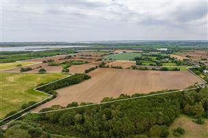
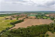
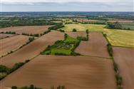
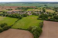
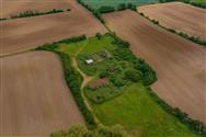
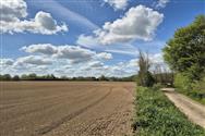
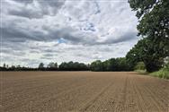
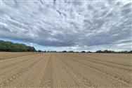
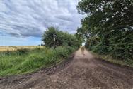
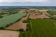
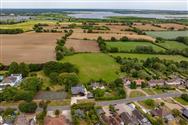
Nevards Farm, Layer Breton, Colchester, Essex, CO2 0PN Colchester – 5 miles, Junction 25 of A12 – 4 miles, Abberton Reservoir – 1 mile (Distances are approximate) GUIDE PRICE: £1,265,000 Available as a whole or in up to two lots Summary An exciting opportunity to acquire an attractive ring-fenced block of Grade 3, predominately arable land extending to approximately 126.07 acres (51.02 ha). Available as a whole in up to two lots. Ideally located on the edge of the village of Layer Breton just outside Colchester. The nearest postcode is CO2 0PN. Location Nevards Farm is located approximately 5 miles south of Colchester and just 5 miles north west from Mersea Island and the Essex coastline. Abberton Reservoir lies approximately 1 mile due east and the land is well positioned to continue as a productive block of farmland or potentially lend itself to alternative uses such as Biodiversity Net Gain, solar or amenity uses. LOT 1 – GUIDE £1,180,000 Lot 1 consists of the majority of Nevards Farm and extends to 122.41 acres in total as shown in blue. Consisting of approximately 116.13 acres of arable land, 2.25 acres of semi mature woodland and 4.03 acres of grass/scrub which surrounds the redundant buildings. The arable land has grown a rotation of combinable crops as well as sugar beet, borage and sweetcorn/squash all being included in the cropping. All the land is classified as Grade 3 with the soils being described as slowly permeable, base rich loamy and clayey soils. There is a set of redundant farm buildings located in the middle of the farm, located in field TL9518 1432. These are in a dilapidated state of repair but potentially provide a footprint (subject to planning) to redevelop. The main access to Nevards Farm is via the farm lane directly off the public highway known as Garlands Road. It should be noted the first small section of the farm lane (approximately 30m) is included within the ownership of Nevards Farm but is registered as common land associated with the adjoining Layer Breton Heath. The farm lane is a hardstanding track which provides good access to the arable land and continues through the middle of the farm to the redundant farm buildings. LOT 2 – GUIDE £85,000 A single grass field extending to 3.66 acres directly adjoining the village of Layer Breton. Benefiting from its own access, this field could be ideally suited to pony paddocks or amenity land (subject to planning). Lot 2 is offered for sale subject to an overage provision should this land secure planning permission for any other use other than agricultural or equestrian use. The provision will be triggered on granting of a planning permission. It will last for 30 years and require payment of 30% of the increase in value. It should be noted that access into this field is via an established right of way across adjoining common land, before leading directly off the public highway known as Layer Breton Hill.
Disclaimer
Property Ref.Fppv1WuT. The information about this property is an advertisement displayed on our website by the agent referred to above. This advertisement does not comprise property particulars. AMC does not warrant its accuracy or completeness or the accuracy or completeness of any linked or associated information. Please see website terms of use